The city of Bucharest has one of the largest public transportation networks in Europe, yet sometimes not the best quality. It is also an important road, railway and aviation hub of Europe, with connections to many places on the continent and beyond. Visitors have many options to reach the city from anywhere in the country and getting around Bucharest using its extensive transportation system. The following article presents the basics of getting to the city and getting around Bucharest. Travelers should nevertheless consult the official sources for each type of transportation for detailed and updated information. As a developing city, transportation within Bucharest changes each year, usually for the better, yet there are frequent construction works.
Getting to Bucharest by Plane
The easiest and fastest way to get to Bucharest from another country is by plane and most travelers will arrive at the Otopeni “Henri Coandă” International Airport. It is located about 16 km north of the city and catered to over 30 million passengers in 2024. It connects the capital of Romania to many other important capitals and major cities of Europe and beyong, including London, Paris, Rome, Amsterdam, Istanbul, Oslo, Vienna, Rome, Munich, Barcelona, Zurich, Dubai, Copenhagen, Warsaw, Tel Aviv, Marrakech, Berlin, Doha, Athens, Brussels, Frankfurt and more.
From the airport, travelers can reach the city by train, bus or taxi service. The regular train service connects Otopeni Airport to the Bucharest North Railway Station, with 24 hours service. It runs every 40 minutes and takes about 20 minutes. The 100 Express Bus Line connects the airport to the center of Bucharest (Unirii Square). It runs every 15 minutes during the day and 30 minutes during the night, with a few stops along the way. There is also the 442 Express Bus Line that connects the city (Press Square) to the airports and continues towards the Therme Spa Resort.

Passengers can buy tickets from the Automated Ticket Machine inside the airport or by using the dedicated online apps. The last option to reach the city from the airport is by taxi service. There are dedicated touch screen terminals to order a taxi, offering a safe and reliable way to get fares and identification information. There are also taxis waiting in front of the arrivals terminal of the airport, all of them being authorized and licensed by the municipality.
Search for Flights to Bucharest on Booking.com!
The second airport of Bucharest is Băneasa “Aurel Vlaicu” located about 7 kilometers north of the city center. It was once much more important, being closed for renovation works and other issues for about 10 years. It was reopened in 2022 but with lower traffic numbers. It has excellent connections to the city, with several bus and trolleybus lines, as well as a metro station (M2 Aurel Vlaicu).
Getting to Bucharest by Train
The biggest and most important train station in Romania is Bucharest North Railway Station and almost all trains (national and international) arrive there. It is located in the northwestern part of the city, a few kilometers from the city center. Trains from all over the country arrive in Bucharest, 6 of the 8 main railway lines starting in the capital. The most important connections to Romanian cities include Ploiești, Brașov, Cluj Napoca, Oradea, Suceava, Galați, Constanța, Craiova and Timișoara. There are also a few international connections arriving in Bucharest (Chișinău, Budapest and Vienna). The Bucharest North Railway Station has excellent connections to the rest of the city, with a metro station (M4 – Gara de Nord) as well as a Tramway Station (44 line) and a few bus stations with multiple lines.
Getting to Bucharest by Car
Bucharest stands at the center of Romanian road network, with the most important national and European roads starting or passing through the city. Travelers can reach the capital from anywhere in the country. The fastest ways is by using the highways and the A1 connects Bucharest to Pitești and farther to Arad and the border with Hungary (although a large portion is under construction). The A2 connects Bucharest to Constanța and the Black Sea, while the A3 goes to Ploiești. There is also a highway that is being constructed around Bucharest (A0). Other important roads that reach Bucharest include the DN1, DN2, DN3, DN4, DN5, DN6, DN7, DN1A and DN71.
GETTING AROUND BUCHAREST
Bucharest has a complex and fairly developed public transportation system, with a metro network that is still expanding, as well as three major surface transportation means, including buses, trolleys and tramways. Unfortunately, for the most part, the underground and surface systems are divided, although most metro stations also coincide with important surface station hubs. There are a few ticket options that allow for travel on both of them.
The Bucharest Metro System
One of the most reliable and fast means of getting around Bucharest, the metro system currently has five main lines. There are plans for a sixth line that will connect the Bucharest North Railway Station to the Otopeni Airport (planned for 2027). The five lines are color coded and easy to navigate, with the M1 line (yellow) having 22 stations on a ring that surrounds the city center. The M2 line (blue) has 15 stations and connects the north and the south of Bucharest.
The M3 line (red) goes from west to east and has 15 lines, having a common portion with the M1. The M4 line (green) only has 8 open stations (of 21 planned) and connects the North Railway Station to the northwest of the city, while the M5 line (orange) has 10 stations (of 22 planned) and connects the southwest to the northeast of Bucharest. The most important metro stations are also hubs to change lines, usually close to the center of the city (Unirii Square, Victoriei Square, Eroilor Square, North Railway Station).
Travelers using the Bucharest Metro System must buy a magnetic card that allows for either a fixed number of trips for a longer period of time or unlimited trips for a fixed period of time. Usually, the most used tickets include the 1 trip for metro or mixed metro and surface, 2 trips, 10 trips (metro or mixed), 1 day (metro and mixed), 72 hours, 1 Week, 1 Month and 1 Year subscription. These cards can be bought from designated ticket booths in some stations and some stations now have contactless cards and allow for mobile payments.

The Bucharest Metro runs daily from 5 am to 11 pm and the frequency depends on the day and time of year, most stations including electronic displays that estimate the arrival of the next train. Some stations also include commercial spaces or direct underground connections to various shopping centers nearby. The bigger hub stations usually include several levels and connecting corridors for changing the lines. It is important also to pay attention to the direction of each line, as usually only the end station of each line being highlighted.
The Bucharest Surface Transport System
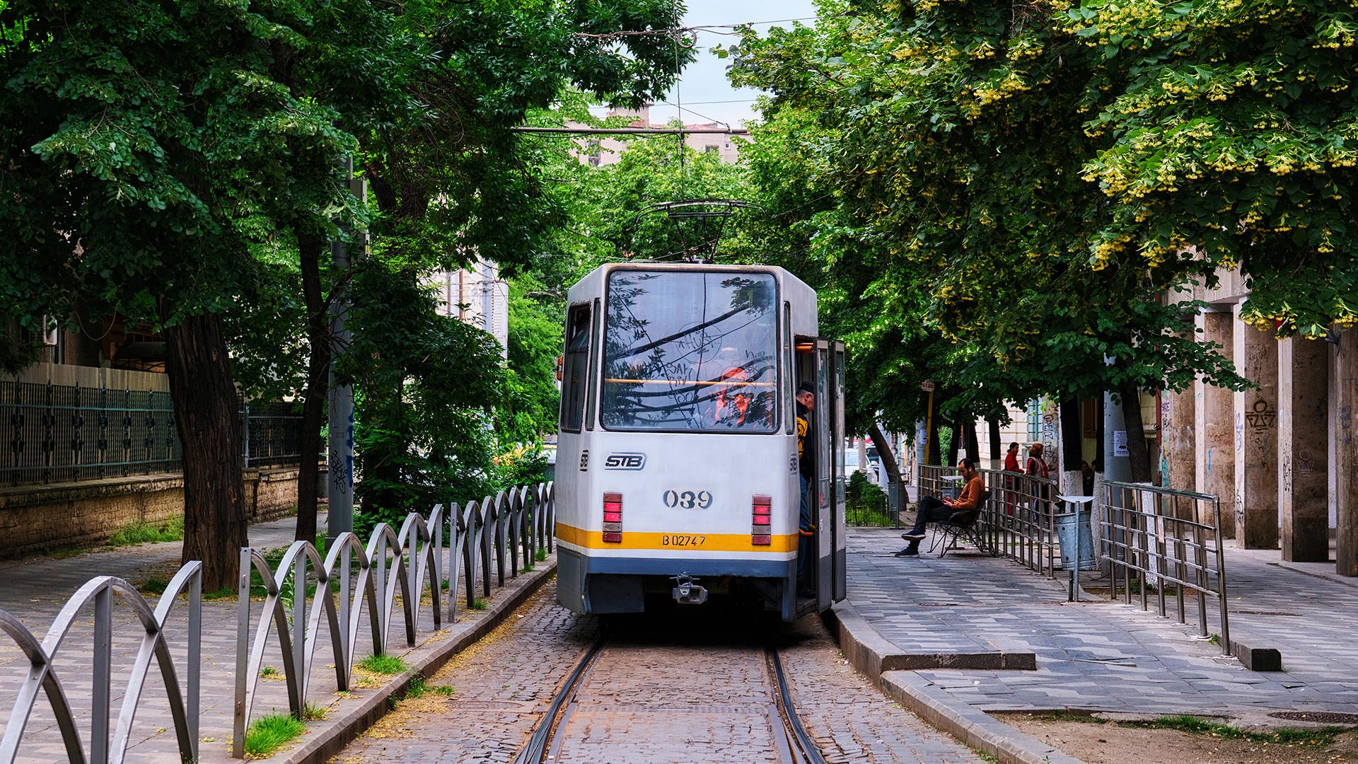
The great majority of surface transportation within the city is operated by STB (Bucharest Transport Company). It includes four main networks (buses, trolleys, tramways and light metro) that are interconnected and usually allow for fast access to the most important metro stations. All of them allow for the same tickets to be used, issued by the STB and similar to the metro system in price and options.
The STB network is considered the fourth largest in Europe and manages over 2 million passengers each day. It has 115 bus lines, 17 trollwybus lines and 21 tramway lines. Although extremely crowded at times and fairly outdated, this system allows for connections to almost all the parts of the city. Unlike the metro that is usually pretty reliable, the surface transportation does often encounter dalays, most of the times due to extremely crowded traffic.
The bus transport network hauls about half of all passengers in Bucharest and there are about 1000 buses at each moment in the city. During rush hours, their speed is extremely low, especially close to the center of the city. There are plans to create special bus lanes along the most crowded segments. The 21 lines of tramways are usually more reliable, but still very slow. There are plans to change the entire infrastructure to light metros that will be completely separated from other traffic.
Taxis and Ridesharing
Although mostly overshadowed by ride sharing companies, there are still taxis available in Bucharest and all of them are nationally regulated and licensed by the city hall. Still, there are cases of fraud and especially foreign travellers could encounter taxi drivers that will try to deceive passengers. Nevertheless, this is no longer a problem as in the past and there are fewer and fewer such cases. In 2024, there were five ridesharing companies that can be used for getting around Bucharest (Uber, Bolt, BlackCab, Elec and Blue) with about 4 times as many cars as taxis.
Driving and Parking in Bucharest
Travellers that wish to drive in Bucharest should be ready for somewhat chaotic and extremely crowded traffic, especially during the week and rush hours. Within the city center and along the busiest boulevards, congestions are frequent and nerves are at a maximum. Some large intersections will be quite challenging to navigate, as there are multiple lanes and sometimes tramway lines to pay attention to. Parking is another problem in Bucharest and especially in the city center, where parking places are very limited. Unless specified, parking is allowed everywhere as long as it is not hindering traffic or is a reserved space. The paid public spaces are always signaled and drivers should pay before leaving the car. There is an official app and an sms option for payment.
Rent a Car in Bucharest with Booking.com!
Planning a Trip (Bucharest Transport Apps)
Transportation in Buchrest is quite complex and planning a trip can be daunting without the necessary tools. Fortunately, there are plenty of apps that can be used to safely travel within the city and beyond. For driving or even walking within the city, Google Maps can be a great asset. Most Romanian also use Waze to navigate the busy streets of Bucharest. Nevertheless, for the public transport system, the best app to use is called Info Transport Bucuresti.
Info Transport Bucuresti – The official app of STB (Bucharest Transport Company) offers an easy and fast way to plana route, including both surface and metro systems. It shows all the lines, connections, ticket selling points, but also live information about the traffic network and online ticket sales where available.
Google Play Store | Apple Store
Parking Bucuresti – Official app for parking within the city of Bucharest, it allows drivers to search for parking places and to pay the fares online. Other apps that can be used for parking in Bucharest and other places in Romani are AmParcat and TPark.


